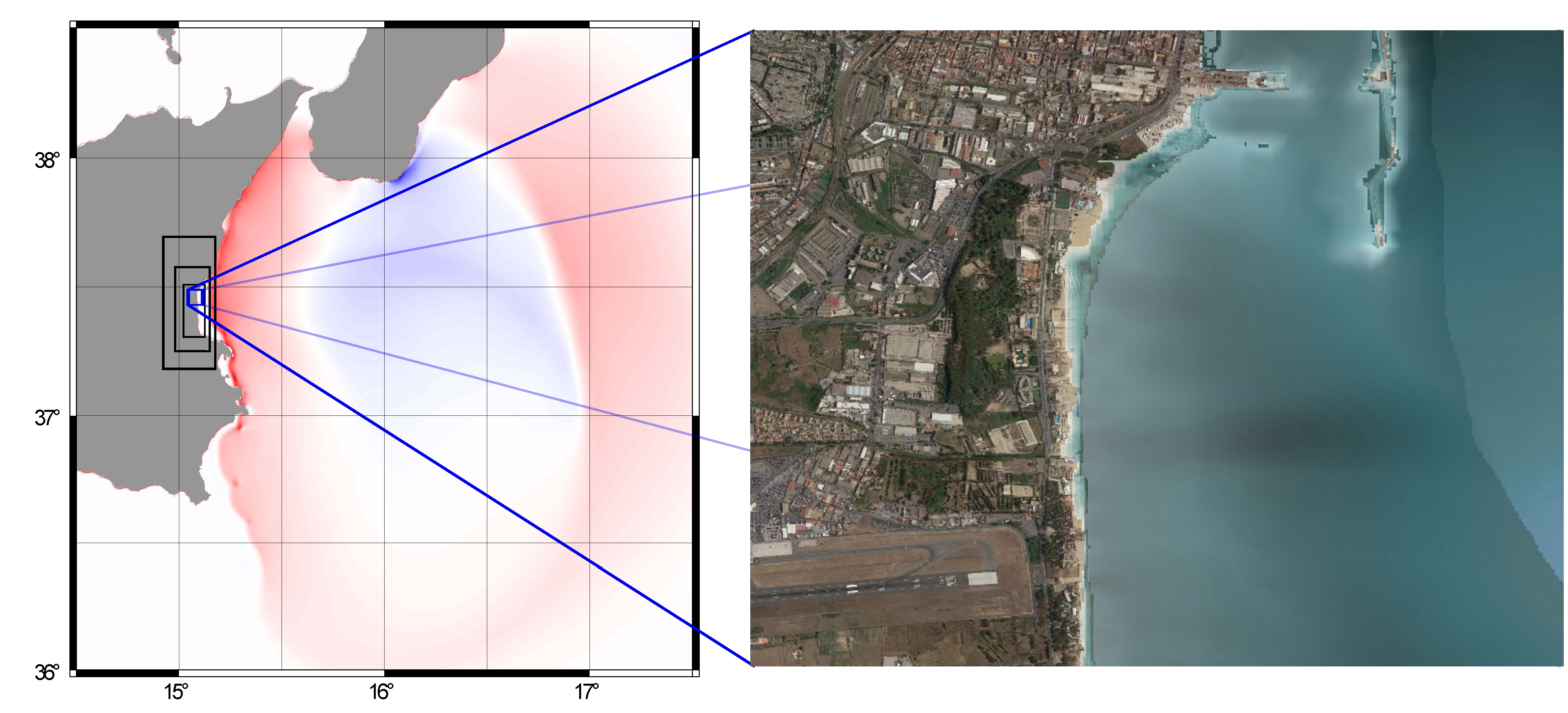
Figure 1: Left, simulation of a tsunami propagating from the Calabrian Arc towards southern Italy. Right, tsunami inundation using a high-resolution map towards an area offshore Catania, Italy. In ChEESE, we will use High Performance Computing to simulate thousands of these kinds of scenarios and use these to represent the coastal tsunami hazard at high resolution.
Tsunamis are long water waves caused by other large natural hazards such as earthquakes, landslides, and volcanoes. They present a threat to near-coastal populations and infrastructure. In ChEESE, new ways of quantifying tsunami hazard will be developed. The main aim is to utilize large High Performance Computing resources to map the tsunami inundation hazard at very high resolution while, at the same time, estimating the large uncertainty associated with tsunamis.
Tsunami hazard analysis tells us how probable it is for an area to be inundated by a tsunami of a given size. Tsunamis of moderate run-up height inundating smaller areas are more frequent, while tsunami with high run-up inundating large areas are less frequent. The frequency of the tsunamis is tightly linked to the frequency of their sources. The most common source is earthquakes.
The uncertainty related to the occurrence probability of any tsunami source is large. Because tsunamis are too infrequent to use data directly to represent the hazard, we need models to do it. To cover the source uncertainty, we need to model tsunamis due to many, often tens to hundreds of thousands of sources. For this, we need High Performance Computing resources.
The most severe tsunami impact may occur locally just after the event has been triggered, but tsunamis can also cause damage several hours after they are generated. Moreover, tsunami wavelengths range from hundreds of kilometres in the open ocean, to a few meters when a tsunami inundates the coastlines. Therefore, tsunami modelling needs to involve a wide range of spatial scales, over a simulation that can span several tens of hours. This, combined with the need for carrying out a huge number of simulations, necessitates extreme computing power.
The most elaborate previous tsunami hazard analyses have so far been carried out on a regional level, and are hence not sufficiently accurate for modelling inundation and map the hazard in detail. In ChEESE, High Performance Computing allows us to model tsunami hazard at high resolution using a sufficient number of potential tsunami sources. Using exascale computing, we can combine a rigorous representation of the tsunami uncertainty with high resolution inundation maps. This will form the background for a next generation of tsunami hazard maps with higher accuracy and better uncertainty representation than is possible using today's methods.In ChEESE, we plan to develop a service that can help users to carry out local hazard studies in their own environment. The service will initially be limited to the Mediterranean Sea, and will let users upload their own high resolution local topography grid for a coastal site to perform hazard mapping. The service will utilize an already existing coarser grained regional tsunami hazard assessment (TSUMAPS-NEAM, http://www.tsumaps-neam.eu/) as the input for setting up the local hazard study. Based on the location of the site, and the hazard level of interest, the service will select the scenarios that are expected to contribute most strongly to the hazard and use High Performance Computing to simulate the inundation from these scenarios.
